Sri Vijaya Puram, November 2: With Cyclonic Storm Murasu gathering strength over the Bay of Bengal, the south Andhra Pradesh coast is preparing for a potentially severe weather event, with the India Meteorological Department (IMD) forecasting winds of up to 120 kmph during the storm’s expected landfall early on November 3.
The storm, which intensified over the southwest and adjoining west-central Bay of Bengal on November 1, is expected to strengthen further into a severe cyclonic storm before moving towards the coast between Nellore and Narsapur. The IMD has warned of heavy to very heavy rainfall, damaging winds and rough seas across several parts of southern and eastern India over the next few days.
The impact is expected to be particularly severe in coastal Andhra Pradesh, Rayalaseema and Telangana, where heavy rainfall is forecast on November 2 and 3. Isolated extremely heavy rainfall is also likely over coastal Andhra Pradesh and Yanam on both days and over Telangana on November 3.
For the Andaman and Nicobar Islands, the forecast indicates isolated to scattered rainfall between November 1 and 7. The islands are not identified as the storm’s projected landfall area.

Storm’s Path
Murasu developed from a well-marked low-pressure area over the southeast Bay of Bengal and adjoining areas of the Andaman and Nicobar Islands and the Andaman Sea. The system concentrated into a depression at 11.30 am on October 31 and subsequently intensified into a deep depression during the early hours of November 1.
Moving west-northwestwards at around 23 kmph during the six hours preceding the morning observation, it strengthened into Cyclonic Storm Murasu at 11.30 am on November 1.
At that time, the storm was centred near latitude 12.1°N and longitude 85.3°E, approximately 560 km east-southeast of Chennai, 630 km east-southeast of Nellore, 640 km southeast of Machilipatnam, 660 km south-southeast of Visakhapatnam and 680 km east-southeast of Ongole.
The IMD forecast that Murasu would intensify into a severe cyclonic storm over the west-central Bay of Bengal by the morning of November 2 before moving northwestwards towards the south Andhra Pradesh coast.
The expected landfall window is between 11.30 pm on November 2 and 4 am on November 3, with sustained wind speeds of 100–110 kmph and gusts reaching 120 kmph.
The forecast intensity chart shows winds of 65–75 kmph, gusting to 85 kmph, at 11.30 am on November 1. These were expected to increase to 70–80 kmph by evening and 80–90 kmph, gusting to 100 kmph, by late night. By the morning of November 2, wind speeds were forecast to reach 90–100 kmph, with gusts up to 110 kmph, before strengthening further around landfall.
The system is expected to weaken after crossing the coast. Wind speeds are forecast to fall to 80–90 kmph, gusting to 100 kmph, by the afternoon of November 3, with the system weakening into a deep depression later that night. It is expected to further weaken into a depression by November 4.
Surge Warning
Along with heavy rain and strong winds, the IMD has warned of a possible storm surge of around one metre above the astronomical tide along low-lying areas of south coastal Andhra Pradesh during landfall.
Bapatla, Krishna and Prakasam districts are expected to experience the maximum peak surge, raising the possibility of inundation in vulnerable coastal settlements.
The storm could cause extensive damage to thatched huts and kutcha houses, while rooftops and unsecured metal sheets may be blown away. Tin-roofed and asbestos-roofed structures are also vulnerable to the expected winds.
The warning extends to trees, power infrastructure and agriculture. Large trees could be uprooted and branches broken, potentially damaging electricity and communication lines. Standing crops, plantations and orchards may suffer substantial losses, with banana, papaya and drumstick trees particularly vulnerable. Falling green coconuts, damaged palm fronds and damage to salt pans and embankments are also among the expected impacts.
Road connectivity could be affected by flooding, waterlogging and damage to vulnerable road stretches. The IMD has cautioned about possible breaches in kutcha roads, flooding of access and escape routes and traffic disruption in urban areas. Riverine, urban and coastal flooding, along with possible landslides in hilly areas, have also been identified as secondary hazards.
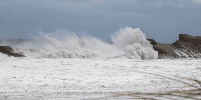
Sea conditions are expected to become extremely dangerous in the storm-affected areas. The IMD has warned of very high seas, with wave heights of around 9–14 metres in areas of concern, severely reduced visibility and unsafe conditions for the movement of boats and ships.
Rainfall Alert
The weather system is expected to influence a large part of southern and eastern India, with different regions facing varying levels of rainfall and wind activity.
Coastal Andhra Pradesh and Yanam are likely to receive heavy rainfall, becoming heavy to very heavy at several places on November 2 and 3. Isolated extremely heavy rainfall is forecast on both days, while isolated heavy rainfall may continue on November 4. Thunderstorms, lightning and strong gusty winds are also expected.
Rayalaseema is likely to receive heavy to very heavy rainfall on November 2 and 3, accompanied by thunderstorms and gusty winds. Isolated heavy rainfall may continue on November 4.
In Telangana, heavy rainfall is forecast at isolated places from November 2 to 4, with extremely heavy rainfall possible on November 3. Thunderstorms and gusty winds are also expected, with wind speeds potentially reaching 70–80 kmph and gusting to 90 kmph during the early hours and afternoon of November 3.
Tamil Nadu, Puducherry and Karaikal are likely to experience heavy rainfall at isolated places between November 1 and 3. Very heavy rainfall is possible on November 1 and 2. The region is also likely to experience thunderstorms, lightning and gusty winds, while the north Tamil Nadu–Puducherry coast is expected to face rough to very rough sea conditions until November 4 morning.
South Odisha is likely to receive fairly widespread rainfall between November 2 and 4. Heavy rainfall is forecast at isolated places on November 2, followed by very heavy rainfall in isolated areas on November 3 and 4. Chhattisgarh is also likely to experience fairly widespread rainfall on November 3 and 4, with isolated very heavy spells possible.
The wider weather outlook includes fairly widespread to widespread rainfall over Kerala and Mahe from November 1 to 7 and over Lakshadweep from November 5 to 7. Coastal and south interior Karnataka are likely to receive fairly widespread rainfall between November 2 and 5, while north interior Karnataka is expected to experience similar conditions from November 3 to 5.
Isolated to scattered rainfall is also forecast over parts of Madhya Pradesh, Vidarbha, Gujarat, Konkan and Goa, as well as Jharkhand, West Bengal, Sikkim, Bihar and the northeastern states during different periods between November 1 and 7. Odisha is expected to receive fairly widespread rainfall from November 2 to 4, with very heavy rainfall possible in south Odisha on November 3 and 4.
Island Outlook
For the Andaman and Nicobar Islands, the IMD has forecast isolated to scattered rainfall throughout the November 1–7 period. The weather system had its origins over the southeast Bay of Bengal and adjoining areas of the islands and the Andaman Sea before moving west-northwestwards.
The latest forecast does not indicate a direct cyclone landfall over the islands or specify a separate severe cyclone warning for the territory. However, the evolving conditions over the Bay of Bengal remain relevant to the islands’ fishing and maritime activities.
Very rough to high sea conditions are forecast over the southeast and southwest Bay of Bengal. The west-central Bay is expected to experience a further deterioration, with seas becoming very rough to high from the afternoon of November 1 and high to very high from the morning of November 2 until noon on November 3.
In the southeast Bay, very rough to high sea conditions are expected to prevail, while the southwest Bay is likely to remain very rough to high until the morning of November 2. Conditions are forecast to improve gradually thereafter, although rough seas may continue for some time.
Along the Andhra Pradesh coast, sea conditions are expected to deteriorate from rough to very rough on November 1 evening, becoming high around midnight and high to very high from November 2 morning until November 3 noon.
Fishing Ban
With dangerous sea conditions expected across the affected waters, the IMD has advised fishermen not to venture into several parts of the Bay of Bengal over the coming days.
Fishing has been prohibited in the southeast Bay of Bengal on November 1 and 2, while fishermen have been advised to remain ashore in the southwest Bay until the morning of November 4 and in the west-central Bay until the afternoon of November 4.
Along and off the Andhra Pradesh coast, the advisory will remain in force from the morning of November 2 until the afternoon of November 4. Fishermen along the north Tamil Nadu–Puducherry coast have been advised not to venture into the sea until the morning of November 4.
Similar restrictions apply to the adjoining northwest Bay of Bengal and the south Odisha coast from the evening of November 2 until the afternoon of November 4.
The IMD has called for the suspension of fishing operations in affected waters and asked fisheries departments and fishing harbour authorities to alert fishing communities and monitor subsequent marine warnings.
Shipping companies, port authorities and offshore operators have also been advised to review their operational preparedness and consider restrictions on activities sensitive to weather conditions. Maritime authorities have been asked to review communication systems, vessel tracking and search-and-rescue arrangements, particularly for vessels operating in vulnerable waters.

Safety Measures
The IMD has advised that people living in vulnerable coastal huts and settlements be moved to safer locations. Residents in affected areas should remain indoors during the storm and avoid staying in weak or vulnerable structures.
Road and rail traffic may need to be regulated depending on local conditions. People have also been advised to avoid routes and locations that are frequently affected by waterlogging and to check traffic advisories before travelling.
For south Odisha, Rayalaseema, adjoining areas of north Tamil Nadu and Telangana, the IMD has warned of damage to thatched and kutcha houses, standing crops, plantations and trees. Flooding could affect roads and disrupt transport, while sea waves of around 4–6 metres are possible in the affected marine areas, making movement in small boats and ships unsafe.
Fisheries departments, harbour authorities and maritime agencies have been asked to remain alert and follow area-specific advisories. The timing and extent of restrictions on fishing, shipping, port operations and marine tourism will depend on subsequent IMD forecasts.
As Murasu moves towards the mainland, the coming hours will be crucial for coastal Andhra Pradesh, where the combination of severe winds, heavy rainfall and a possible storm surge could create difficult conditions. For the Andaman and Nicobar Islands, the immediate forecast remains one of scattered rainfall, with residents and marine operators advised to keep track of official weather updates.