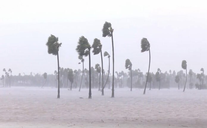
Chennai, Nov 16: A developing weather system over the Bay of Bengal is expected to intensify into a very severe cyclonic storm and approach the Andhra Pradesh coast by November 19, prompting rainfall alerts across parts of southern India and warnings for fishermen along the north Tamil Nadu coast, the southwest Bay of Bengal and the Andaman Sea.
The India Meteorological Department (IMD) said the deep depression would strengthen into a cyclonic storm on Monday evening, a severe cyclonic storm by Tuesday evening and further intensify as it moves northwestwards over the west-central Bay of Bengal. It is expected to reach the waters near the Andhra Pradesh coast around the night of November 19.
At 5.30 am on Monday, the system was centred over the southeast and adjoining southwest Bay of Bengal. It lay about 680 km west of Sri Vijaya Puram, 720 km east-southeast of Chennai, 820 km south-southeast of Visakhapatnam and 940 km south of Gopalpur in Odisha, according to the IMD.
The department said the system had moved north-northwestwards and was likely to maintain its direction while gaining strength over the next few days.

The approaching system has also raised the prospect of heavy rainfall across northern Tamil Nadu. The Chennai Meteorological Department forecast heavy showers at isolated places in Chennai, Tiruvallur and Chengalpattu from Tuesday, with very heavy rainfall likely in all three districts on November 18 and 19.
Other districts expected to receive heavy rainfall on Wednesday include Kancheepuram, Ranipet, Tiruvannamalai, Villupuram, Cuddalore and Mayiladuthurai, along with Puducherry. The forecast marks an increase from moderate rainfall expected at isolated locations along northern coastal Tamil Nadu, Puducherry and Karaikal on Monday.
The rainfall outlook for Andhra Pradesh is also expected to worsen as the system approaches the coast. The Andhra Pradesh State Disaster Management Authority (SDMA) said the deep depression had moved at a speed of 8 kmph during the six hours preceding its update.
Prakhar Jain, Managing Director of the SDMA and Chief Executive Officer of the Real Time Governance Society, said the system was expected to develop into a cyclonic storm over the south-central and west-central Bay of Bengal before strengthening further. Coastal Andhra Pradesh is likely to experience heavy to very heavy rainfall accompanied by strong winds on Thursday and Friday.

Winds of 40–60 kmph are expected along the Andhra Pradesh coastal belt from Monday evening. The IMD and state authorities have advised fishermen against venturing into the sea, while residents and farmers have been urged to take precautionary measures.
The marine warning also covers the north Tamil Nadu coast, the southwest Bay of Bengal and the Andaman Sea, where winds could reach 60 kmph as the system develops.
The approaching storm comes after two cyclonic systems affected the Andhra Pradesh coast within a week. Very severe cyclonic storm Arnab struck the coast on October 27, followed by severe cyclonic storm Murasu, which crossed between Nellore and Narasapur on November 3. The two systems claimed 15 lives and caused widespread damage to infrastructure and crops in coastal districts.
The current system would be the third cyclonic storm in the Bay of Bengal expected to cross the Andhra Pradesh coast within 20 days, according to the report.